Winter Storm Watch Explained: Preparation, Safety Tips, and 2026 Alerts
Winter Storm Watch Explained: Preparation, Safety Tips, and 2026 Alerts
Winter 2025–26 was the second-warmest in US records going back to 1895, according to NOAA's Climate Prediction Center — yet it produced two of the most destructive and deadly winter storm events in modern American history within a 30-day span. The January 22–27 winter storm killed at least 167 people across more than 20 states, left 800,000 customers without power, generated insured losses of $4–7 billion according to Fitch Ratings, and covered more than half the contiguous United States in snow simultaneously. Less than four weeks later, the February 22–24 Blizzard of 2026 — the most powerful nor'easter since at least 2017 — dropped 1–3 feet of snow from Philadelphia to Boston, killed at least 30 people, cancelled approximately 8,000 flights, and broke snowfall records in New Jersey, Rhode Island, Massachusetts, and Connecticut that had stood since 1978 and 1996.
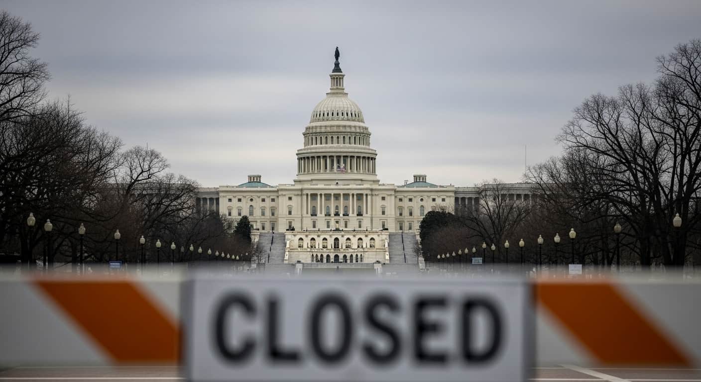
Both events began as winter storm watches — the earliest advisory tier in the National Weather Service's alert system, issued 24 to 72 hours before expected onset. For millions of Americans, those watches were the first signal to prepare. The communities that acted on them — stockpiling supplies, pulling vehicles off roads, checking on neighbors — reduced their exposure to the storm's worst effects. Those who waited for a warning or ignored the watch had hours less time to respond. Understanding what a winter storm watch means, what actions it calls for, and how it differs from higher-alert categories is the practical foundation of winter storm preparedness.
What Is a Winter Storm Watch?
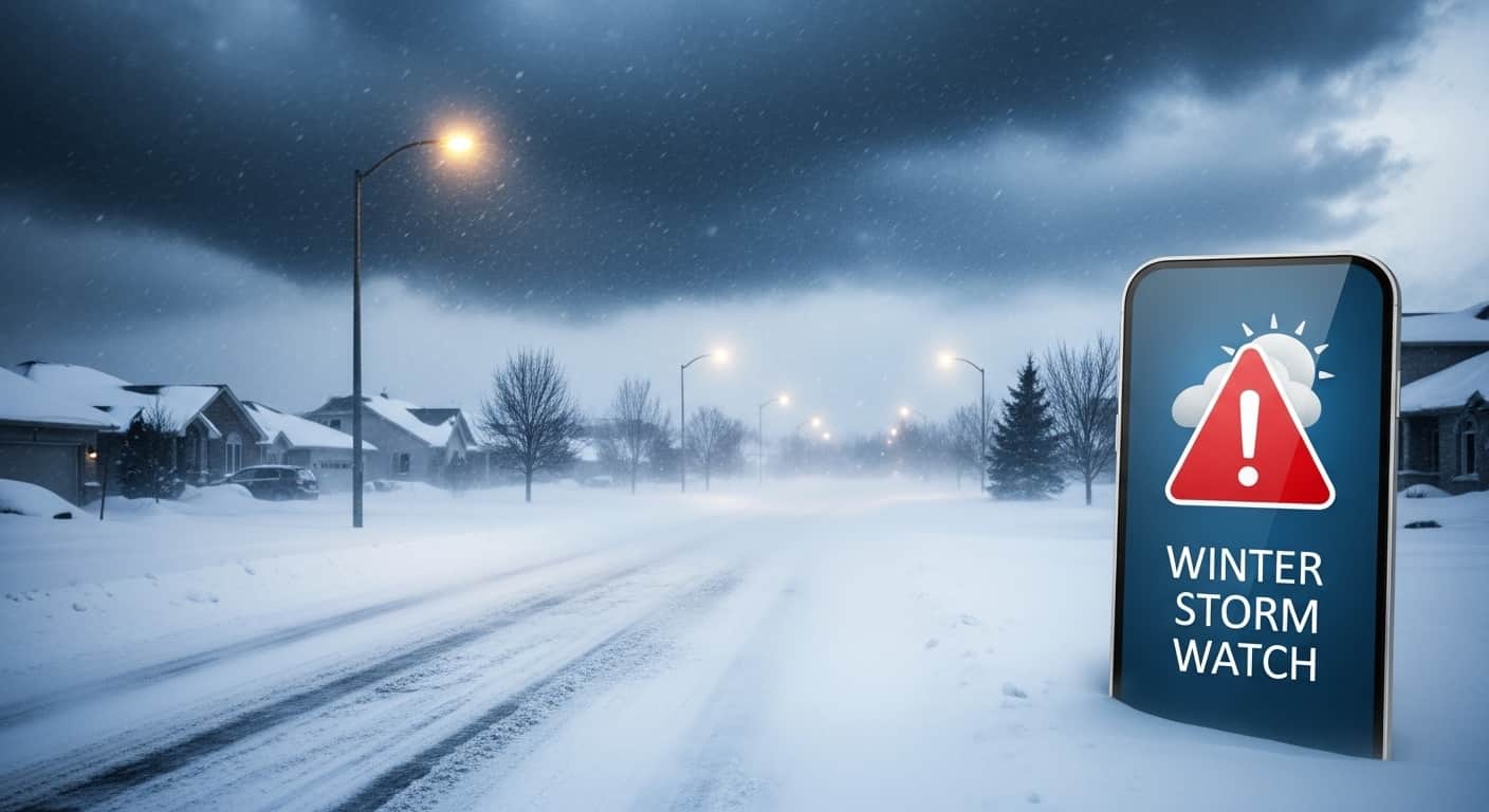
A winter storm watch is an advisory issued by the National Weather Service (NWS) when conditions are favorable for a significant winter weather event — but the timing, track, and intensity of the storm are not yet certain enough to issue a warning. A watch means: the threat is real, the science supports preparing now, but meteorologists need additional observational data before committing to a warning-level forecast.
Watches are typically issued 24 to 72 hours before the expected onset of winter weather. This lead time is intentional — it gives households, businesses, emergency management agencies, road crews, and transportation systems enough time to prepare before conditions deteriorate. Acting during the watch phase, before a warning is issued, is always safer than scrambling after a warning confirms the storm is imminent or already arriving.
Winter storm watches are issued for a specific geographic area — typically by county or forecast zone — and include the anticipated type of weather (heavy snow, ice storm, blizzard conditions, freezing rain), the expected time window, and the forecast snow accumulations or ice thickness that triggered the watch threshold. The NWS issues watches through weather.gov, the NOAA Weather Radio network, and the Emergency Alert System that delivers alerts to phones, TVs, and radios.
Winter Storm Alert Types: Watch vs Warning vs Advisory
| Alert Type | What It Means | Lead Time | Conditions That Trigger It | Recommended Action |
|---|---|---|---|---|
| Winter Storm Watch | Significant winter weather is possible — conditions favorable but not yet certain. NWS confidence is growing but not high enough for a warning. | 24–72 hours before onset | Forecast models showing potential for: 6+ inches of snow in 12 hours, 4+ inches in 24 hours, or significant ice accumulation (0.25 inch+), but with enough uncertainty to warrant a watch rather than warning | Begin preparation immediately — stock supplies, winterize vehicle, review plans, monitor NWS updates every 6–12 hours for upgrade to warning |
| Winter Storm Warning | Severe winter weather is imminent or already occurring — NWS confidence is high. Life-threatening conditions expected. | 12–24 hours before onset (sometimes less) | Heavy snow (6+ inches / 12 hours; 8+ inches / 24 hours), significant ice accumulation (0.25 inch+), or blizzard conditions (sustained 35 mph winds + snow reducing visibility to under 0.25 miles for 3+ hours) | Take immediate protective action — avoid all non-essential travel, stay indoors, confirm emergency supplies are accessible, charge devices |
| Blizzard Warning | Sustained or frequent gusts of 35 mph+ combined with falling or blowing snow reducing visibility to under 0.25 miles for 3+ consecutive hours — the most dangerous winter storm category | 12–24 hours before onset | Sustained 35 mph winds + blowing snow reducing visibility to 0.25 miles or less for 3+ hours — regardless of snow accumulation amount | Do not travel under any circumstances unless it is a life-threatening emergency. Many blizzard fatalities occur in vehicles. |
| Winter Weather Advisory | Nuisance winter weather expected — hazardous but not severe enough for a watch or warning. Travel will be difficult but is not life-threatening for prepared drivers. | 6–24 hours before onset | 1–3 inches of snow, light ice accumulation, or brief periods of reduced visibility — conditions that create hazards but not emergencies | Use caution — reduce travel speed, allow extra time, ensure vehicle is prepared. Not a reason to cancel travel for most situations. |
| Freezing Rain Advisory / Ice Storm Warning | Advisory: Light ice accumulation (under 0.1 inch). Warning: 0.25 inch+ of ice accumulation expected — trees down, power outages, and extremely dangerous travel conditions. | Varies — 12–48 hours for warnings | Ice accretion rates and duration from freezing rain. Ice storm warnings represent some of the most dangerous winter weather events — ice weighs significantly more than snow and brings down power lines and trees. | Ice Storm Warning: treat as equivalent to a blizzard warning. Do not drive. Ice-covered roads are far more dangerous than snow-covered roads. |
| Wind Chill Watch / Warning / Advisory | Dangerously cold air temperatures combined with wind creating life-threatening exposure risk — particularly for vulnerable populations. | Wind Chill Warnings: below -20°F to -35°F (varies by region) for 3+ hours | NWS wind chill thresholds vary by climate region — what triggers a warning in the South differs from the Midwest or Mountain West | Limit outdoor exposure. Cover all exposed skin. Check on elderly neighbors, outdoor workers, and homeless populations. Bring pets inside. |
Major Winter Storms of 2026: What Actually Happened
Winter 2025–26 produced a documented series of major winter storm events — each beginning with winter storm watches issued by the NWS. Understanding what these storms produced in real terms clarifies why the watch-to-warning system exists and why preparation during the watch phase matters.
| Storm | Dates | States Most Affected | Peak Impacts | Fatalities |
|---|---|---|---|---|
| January 22–27, 2026 Major Winter Storm (unofficially named Winter Storm Blair by some outlets) | January 22–27, 2026 — 5-day event tracking from Pacific origins to Atlantic coast | Texas, Mississippi, Louisiana, Tennessee, Kentucky, Indiana, Ohio, Illinois, Missouri, North Carolina, Virginia, Maryland, Northeast | 800,000+ customers lost power at peak — most severe in Tennessee, Mississippi, and Louisiana. Nashville set record for ice-related power outages. Snow covered more than half the contiguous US simultaneously. Columbus, Ohio broke daily snowfall record (11.9 inches vs 4.7 in 1988). Little Rock broke daily record last set in 1899. Extreme Cold Warnings extended to the Mexican border. Ice Storm Warnings across much of the Southeast. | At least 167 fatalities across 20+ states — deadliest US winter storm since the 2021 Texas power crisis. Deaths from hypothermia, carbon monoxide poisoning, vehicle accidents, fallen trees, and flooding. Three Texas siblings died in an icy pond. Indiana: 13 storm fatalities. Mississippi: 10 fatalities including 6 in Panola County alone. Kentucky: 10+ fatalities. Texas: 9 fatalities. Tennessee: multiple including 2 in carbon monoxide poisoning in DeSoto Parish. |
| January 30–February 2, 2026 Bomb Cyclone (Winter Storm Gianna) | January 30–February 2, 2026 — nor'easter and bomb cyclone | Carolinas, Georgia, Virginia, Atlantic Canada (Newfoundland, Nova Scotia) | Charlotte Douglas Airport: 11 inches of snow tying December 1880 record for 4th-highest single-day total. Carolinas: 12–24 inch accumulations — heaviest in many years. 500+ flights cancelled at Atlanta by 10:45 AM January 31. Record cold reached Miami and West Palm Beach February 1. NC Highway 12 closed. South Carolina and North Carolina governors declared states of emergency. | Multiple fatalities — including carbon monoxide poisoning, hypothermia in Anderson County SC, vehicle accidents across Carolinas and Tennessee. Tennessee Emergency Management reported 3 deaths in East Tennessee. |
| February 22–24, 2026 Blizzard (Winter Storm Hernando / Blizzard of 2026) | February 22–24, 2026 — historic nor'easter | Delaware, New Jersey, New York City, Connecticut, Rhode Island, Massachusetts, Maryland, Pennsylvania, Virginia | RI T.F. Green Airport: 37.9 inches — snowiest single day and two-day total on record, beating records from 1978. Whitman, MA: 33.7 inches. North Stonington, CT: 30.8 inches. Philadelphia: 14 inches, breaking 1987 record. Wellfleet, MA: 98 mph peak wind gust. 600,000+ power outages at peak. 8,000 flights cancelled February 22–23. 22,000+ flights delayed by February 22 evening. Nearly 1,000 cancellations from Newark alone. First blizzard warning for all 21 New Jersey counties since January 1996. | At least 30 confirmed fatalities: 15 in New Jersey, 6 in New York, 2 each in Connecticut, Maryland, Pennsylvania, and Rhode Island, 1 in Massachusetts. Deaths included carbon monoxide poisoning (student buried in car), shoveling heart attacks, a man struck by a tractor-trailer while clearing snow on Mass Pike, and vehicle accidents. |
| FEMA Major Disaster Declarations | Issued following January 22–27 storm | Mississippi (Major Disaster Declaration approved by President Trump), Tennessee (Major Disaster Declaration approved) | Federal disaster assistance made available to supplement state recovery efforts. FEMA activated Disaster Information Reporting System for affected radio stations. | Declarations confirm official federal government classification of the storm's impact as exceeding state and local response capacity. |
Why Are Powerful Winter Storms Increasing?
The apparent paradox of the second-warmest winter on record producing two of the deadliest winter storms in modern US history reflects the complexity of how a warming climate affects winter weather patterns rather than simply eliminating them.
A warmer Arctic reduces the temperature differential between the polar region and mid-latitudes — a condition that weakens the polar vortex, allowing Arctic air masses to plunge further south than they historically would. This is the mechanism that brought Extreme Cold Warnings to the Mexican border during the January 2026 storm — a pattern that would have been climatologically unusual in the mid-20th century but has become more frequent. At the same time, warmer atmospheric temperatures hold more moisture, meaning when winter storms do form, they can produce heavier precipitation rates — contributing to the record accumulations recorded in Rhode Island and Massachusetts during the February 2026 blizzard.
Improved forecasting technology — including NOAA satellite monitoring that tracked the January 2026 storm from its Pacific origins on January 21 through its Atlantic coast impacts on January 26 — means warnings are now more accurate, earlier, and more geographically specific than they were even a decade ago. The NWS issued winter storm watches for the Northeast more than 48 hours before the February blizzard's peak — giving communities the preparation window that the watch system is designed to provide.
Complete Winter Storm Preparation Checklist
Winter storm preparation should begin immediately when a watch is issued — not when a warning is confirmed. By warning issuance, stores are often depleted of essential supplies, roads may already be deteriorating, and the preparation window is significantly compressed. The following checklist is organized by category.
| Category | What to Prepare | Why It Matters in a Real Storm |
|---|---|---|
| Food and water | 3–7 day supply of non-perishable food requiring no cooking or refrigeration; 1 gallon of water per person per day for 3–7 days; manual can opener; pet food if applicable | The January 2026 storm left 800,000 customers without power for days to over a week in Tennessee, Mississippi, and Louisiana. Grocery stores in affected areas ran out of essentials within hours of watch issuance. A week's supply is not excessive — it is the documented real-world requirement. |
| Heating backup | Alternative heating source (wood-burning fireplace, propane heater rated for indoor use with proper ventilation, generator); extra firewood or fuel; carbon monoxide detector with fresh batteries; extra blankets and sleeping bags | Carbon monoxide poisoning was one of the leading causes of death in both the January and February 2026 storms — students and families running vehicles in garages or using outdoor equipment indoors for heat. A working CO detector and a safe indoor heating backup are life-safety items, not optional. |
| Power backup and lighting | Flashlights with extra batteries; battery-powered or hand-crank weather radio (NOAA Weather Radio); portable battery bank for phone charging; candles with safe holders | 600,000+ people lost power during the February 2026 blizzard. Without a battery-powered weather radio, people in power outages lose access to NWS updates precisely when they need them most. A portable battery bank allows phone charging for emergency communication and weather app access. |
| Medications and medical needs | 30-day supply of all prescription medications if possible; over-the-counter first aid supplies; extra supplies for medical devices (CPAP, nebulizer, oxygen concentrator); extra eyeglasses | The January 2026 storm caused an oxygen concentrator failure that killed two people in Louisiana due to the regional power outage. Medical device users should have battery backups, know their device's runtime on backup power, and have a plan for extended outages. |
| Vehicle preparation | Full fuel tank (keep above half-full throughout storm season); winter tires or all-season tires with adequate tread; ice scraper and snow brush; jumper cables or battery jump starter; blanket, warm clothes, and boots in vehicle; sand or cat litter for traction; shovel; fully charged phone and car charger | The most common scenario for storm fatalities is becoming stranded in a vehicle. The February 2026 blizzard occurred with little warning for some travelers already on the road. A vehicle emergency kit and full fuel tank can be life-saving if you become stranded. |
| Home weatherization | Weather-strip doors and windows; insulate pipes in unheated areas (garage, crawlspace, exterior walls) with pipe insulation or heat tape; know where your water main shutoff is located; clear gutters of leaves before freeze | Burst pipes are the most expensive home damage from winter storms — water damage from a single burst pipe can exceed $10,000. Insulating exposed pipes before a storm is significantly cheaper than emergency plumbing repairs. |
| Communication and information | NOAA Weather Radio (battery powered); emergency contacts list on paper (not only in phone); know your local emergency management agency's notification system and how to sign up for local alerts; check on elderly and vulnerable neighbors before the storm | During the February 2026 blizzard, cell networks were congested or disrupted in heavily affected areas. Having emergency contacts written down and a battery-powered weather radio ensures you remain informed and connected regardless of power and cell service status. |
Winter Storm Safety Rules: During the Storm
- Stay off roads unless travel is a genuine emergency. The single most effective action you can take during a winter storm warning or blizzard warning is to not drive. The majority of winter storm fatalities in 2026 — and in every major winter storm — occurred in or near vehicles. Over 400 traffic accidents were reported in North Carolina alone during the January 30 storm. 131 crashes occurred in Massachusetts by 4 PM on the second day of the February blizzard. Road treatment cannot keep pace with heavy accumulation rates. Even four-wheel-drive vehicles cannot stop on ice.
- Never run a vehicle in a garage, even with the door open. Carbon monoxide poisoning is a top-3 cause of winter storm fatalities in every major event. CO is odorless and colorless — there are no physical warning signs before incapacitation. The only protection is a working carbon monoxide detector and strict policy: no vehicle, generator, grill, or camp stove inside any enclosed space including garage, basement, or tent attached to a building.
- Run generators exclusively outdoors, at least 20 feet from any window, door, or vent. Generator exhaust kills within minutes at close range. During the January 2026 storm, multiple fatalities in Louisiana involved CO poisoning from indoor generator use during the extended power outage. Keep the generator away from the house and run an extension cord inside — not the generator.
- Dress in layers when venturing outside — even briefly. Core body temperature drops fast in wind chill conditions. The January 2026 storm brought Extreme Cold Warnings extending to the Mexican border. Wind chill can cause frostbite in exposed skin in under 30 minutes at temperatures that do not feel dangerous to someone accustomed to cold weather. Cover the face, hands, and feet — the extremities are the first to lose circulation.
- Shovel snow in intervals, not all at once. Shoveling is strenuous cardiovascular exercise performed in cold air — a combination that places significant stress on the heart. Shoveling-related cardiac deaths occur in every major snowstorm. Take frequent breaks, do not shovel immediately after waking, and do not shovel if you have known heart disease or are significantly out of condition. Use an ergonomic shovel and push rather than lift where possible.
- Check on elderly neighbors and vulnerable individuals before, during, and after the storm. Hypothermia kills at indoor temperatures if heating fails and a person cannot generate enough body heat. Elderly people and those with limited mobility face the highest risk from extended power outages. The January 2026 storm produced hypothermia deaths in North Carolina and South Carolina in people who lost home heating. A welfare check on a neighbor can save a life.
- Keep one room of the house warm as a thermal refuge during an extended heating outage. If your main heating system fails during a storm, consolidate your household into a single interior room. Close off doors to conserve body heat in that space. Use sleeping bags rated for cold temperatures. A well-insulated interior room retains body heat far better than an entire house.
- Do not walk across frozen ponds, lakes, or streams regardless of appearance. The January 2026 storm produced the death of three Texas siblings in an icy pond. Ice thickness and stability are not reliably assessed by visual inspection, particularly during or immediately after a storm when ice may be covered by snow that masks weak spots or open water.
How to Stay Updated: Real-Time Winter Storm Alerts
| Alert Source | What It Provides | How to Access | Best For |
|---|---|---|---|
| National Weather Service (NWS) | Official winter storm watches, warnings, advisories, and local forecasts for every county in the US — updated continuously as storm systems develop | weather.gov — enter your location or zip code for local forecast and active alerts page | The authoritative source — all other alert systems ultimately derive their data from NWS forecasts. Check weather.gov directly rather than relying solely on app interpretations. |
| NOAA Weather Radio All Hazards | 24/7 broadcast of current weather conditions, forecasts, and all watches/warnings for your area — continues operating when internet and cell service are down | Battery-powered or hand-crank NOAA Weather Radio receiver — available at hardware stores for $20–$50. Program your county's SAME code to receive alerts only for your specific area. | The only reliable alert source when power and cell service are out — which is precisely when you most need storm information. Every home should have one. |
| Wireless Emergency Alerts (WEA) | Push notifications sent automatically to all cell phones in an affected area — no signup required. Used for extreme weather events including tornado warnings, flash flood emergencies, and extreme cold warnings. | Automatic on all compatible smartphones. Ensure Emergency Alerts are enabled in your phone's notification settings — do not disable them. | Immediate notification without any action required — your phone receives the alert when you are in the affected area even without an active weather app. |
| Local emergency management notification systems | County and city-level emergency notifications — evacuation orders, road closures, warming center openings, specific local guidance beyond what NWS forecasts provide | Search '[your county] emergency alerts' or '[your county] Nixle' to sign up for text and email alerts from your local emergency management agency. Most counties have free notification systems. | Local alerts provide specific actionable information — which roads are closed, where warming centers are open, when curfews are in effect — that national sources do not. |
| Weather apps (Accuweather, Weather Channel, NOAA app) | Visual forecast maps, hour-by-hour precipitation timelines, storm tracking, and NWS alert push notifications through your smartphone | Download and configure to your location. Ensure background app refresh is enabled so alerts reach you even when the app is not open. Enable notification permissions. | Convenient daily monitoring and visual storm tracking — best used as a supplement to NWS direct access, not as a replacement. App forecasts are derived from NWS data but may present it with slight delays or interpretation differences. |
After the Storm: What to Do When It Ends
The period immediately after a major winter storm ends carries its own hazards — and the decisions made in the first hours after the storm often determine whether storm-related injuries and deaths continue to accumulate.
- Wait for roads to be treated before driving. Road treatment takes time — highways are prioritized before secondary roads and residential streets. Road surfaces that appear clear may have a thin layer of invisible black ice where melt water has refrozen at night or in shaded areas. The February 2026 blizzard produced road fatalities in the days after the storm, not only during it.
- Inspect your roof for dangerous snow accumulation before entering. Heavy wet snow — the kind produced by the February 2026 nor'easter — weighs significantly more than dry powder. Flat or low-pitch roofs can accumulate dangerous structural loads. If you can see snow bending gutters, hear creaking, or notice sagging, do not enter the structure without assessment.
- Report downed power lines immediately and do not approach them. After the February 2026 blizzard, over 600,000 people were without power at peak. Downed lines from ice and wind loads remain energized until utility workers de-energize them. Treat every downed line as live — stay at least 30 feet away and call 911.
- Check on elderly neighbors and those who may have been without heat during the storm. Hypothermia can develop slowly in indoor environments where heating has been lost, and elderly individuals may not communicate distress clearly. A welfare check immediately after the storm ends is as important as one during the storm.
- Document damage thoroughly before any cleanup for insurance purposes. Photograph all damage from multiple angles before beginning any clearing or repair work. Contact your insurance provider promptly — major winter storms generate high claim volumes and early filing improves processing time.
Conclusion
The winter of 2025–26 produced irrefutable evidence that winter storm watches matter. The January 22–27 storm — 167 fatalities, $4–7 billion in insured losses, 800,000 power outages — and the February 22–24 Blizzard of 2026 — 30 fatalities, 8,000 cancelled flights, record snowfall from Philadelphia to Rhode Island — both began as winter storm watches issued days in advance by the National Weather Service.
The watch system works. Communities that act on watches — preparing supplies, pulling vehicles off roads, checking on neighbors, charging devices, and confirming heating backup — consistently experience fewer storm-related injuries and deaths than those that wait for a warning or ignore alerts altogether. The preparation checklist in this guide applies to every major winter storm event, not only the ones already documented. Winter storm watches will continue to be issued as long as winter weather patterns exist in North America. Each one is an invitation to prepare while time still allows.
FAQ
Frequently Asked Questions
What does a winter storm watch mean and what should I do?
A winter storm watch means the National Weather Service has determined that conditions are favorable for a significant winter weather event — typically within the next 24 to 72 hours — but the timing, track, and intensity of the storm are not yet certain enough to issue a warning. It is the earliest formal alert in the NWS winter weather advisory system, and it is designed specifically to give you time to prepare before conditions deteriorate. When a watch is issued for your area, you should begin preparation immediately: stock food and water for 3–7 days, fill your vehicle's fuel tank, ensure you have a battery-powered or hand-crank weather radio, confirm you have a safe indoor heating backup and a working carbon monoxide detector, check on elderly neighbors, and monitor NWS updates at weather.gov every 6–12 hours for possible upgrade to a warning. The critical mistake is waiting for the warning to start preparing — by the time a warning is issued, grocery stores are often depleted, roads may already be deteriorating, and your preparation window has shrunk from 48 hours to 12.
How is a winter storm watch different from a warning?
A winter storm watch means severe winter weather is possible — NWS forecasters see a favorable setup but need more data to confirm the storm's track and intensity. It is issued 24–72 hours in advance. A winter storm warning means severe winter weather is imminent or already occurring — NWS confidence is high enough to commit to the forecast. It is typically issued 12–24 hours before onset. The practical difference is urgency and certainty. A watch says 'prepare now while you have time.' A warning says 'take protective action immediately.' There is also a blizzard warning — the most serious winter weather alert — issued when sustained or frequent gusts of 35+ mph combined with blowing snow will reduce visibility to under 0.25 miles for three or more consecutive hours. The February 22–24, 2026 blizzard triggered blizzard warnings for all of New Jersey, New York City, Delaware, Connecticut, and parts of New England — in many cases the first blizzard warnings since 1996 and 2017 for those areas. A winter weather advisory, by contrast, indicates minor conditions — 1–3 inches of snow or light ice — that create hazards but not emergencies.
How deadly were the 2026 winter storms?
The winter of 2025–26 produced two major deadly winter storms in rapid succession. The January 22–27, 2026 winter storm killed at least 167 people across more than 20 states — making it the deadliest US winter storm since the 2021 Texas power crisis, which killed nearly 250 people. It surpassed the December 2022 Buffalo Blizzard of the Century (approximately 106 deaths). The fatalities resulted from hypothermia, carbon monoxide poisoning (from generators and vehicles run in enclosed spaces), vehicle accidents, fallen trees, and drowning. Fitch Ratings estimated insured losses nationwide at $4–7 billion. FEMA issued Major Disaster Declarations for Mississippi and Tennessee. The February 22–24, 2026 Blizzard of 2026 killed at least 30 people across the Northeast — 15 in New Jersey, 6 in New York, and multiple fatalities in Connecticut, Maryland, Pennsylvania, Rhode Island, and Massachusetts. Deaths included carbon monoxide poisoning, cardiac events from shoveling, vehicle accidents, and a pedestrian struck on the Massachusetts Turnpike while clearing snow. Combined, the two storms killed approximately 200 people within a 30-day period.
When should winter storm preparation start?
Preparation should begin immediately when a winter storm watch is issued for your area — not when a warning is confirmed, and not the morning of the storm. The watch-to-warning window of 24–72 hours is the preparation window the NWS system is designed to provide. Once a warning is issued, grocery stores in storm-affected areas typically deplete essential supplies within hours. During both major 2026 storms, store shelves in affected cities were stripped of bread, water, batteries, and medications well before warning issuance. Roads may already be deteriorating. Emergency services are moving to pre-deployment positions. If you are shopping for supplies after a warning is issued, you are competing with everyone else who waited — and the supplies may not be there. Year-round readiness is actually more efficient: keeping a standing 3–7 day food and water supply, maintaining your vehicle's fuel above half-tank from November through March, and storing a basic emergency kit means the watch simply confirms what you are already prepared for, rather than triggering a scramble.
Why are winter storm 2026 alerts important?
Winter storm alerts — particularly watches issued 24–72 hours in advance — are important because they provide the preparation window that separates communities with minimal storm casualties from those with significant ones. The January 2026 storm killed 167 people and generated $4–7 billion in insured losses. The February 2026 blizzard killed 30 more and cancelled 8,000 flights. Both events were forecast with remarkable accuracy by NOAA satellites and NWS models — the January storm was tracked from its Pacific origins on January 21 through its US impacts January 24–26. Communities that responded to watches by preparing supplies, pulling vehicles off roads, and preemptively activating warming centers experienced better outcomes than those that waited. FEMA's disaster declarations for Mississippi and Tennessee following the January storm triggered federal assistance — but that assistance arrives after the event. Watches arrive before. The NWS, NOAA Weather Radio, Wireless Emergency Alerts, and local county emergency management notification systems together provide layered alert coverage — using all of them gives you the earliest possible warning and the maximum preparation time.
What are the most common causes of death in winter storms?
Based on documented fatalities from the January 22–27 and February 22–24, 2026 storms and historical winter storm data, the most common causes of death are: vehicle accidents (the single largest category — both storms produced hundreds of accidents; the majority of storm fatalities overall involve motor vehicles), carbon monoxide poisoning (generators, vehicles, and outdoor heating equipment run in enclosed spaces without ventilation — multiple confirmed CO deaths in Louisiana, Rhode Island, and Texas in the 2026 storms), hypothermia (particularly affecting elderly individuals who lose home heating during extended power outages, and anyone stranded outdoors or in an unheated vehicle), shoveling-related cardiac events (physically demanding exertion in cold air places extreme stress on the cardiovascular system — confirmed shoveling deaths in Rhode Island and Massachusetts during the February 2026 blizzard), and structural incidents (tree falls, roof collapses, and downed power lines — a 73-year-old in Mississippi died when a tree fell on his mobile home in the January storm). The prevention for each is directly connected to the preparation and safety rules in this guide — staying off roads eliminates vehicle accident risk, a working CO detector prevents poisoning deaths, emergency heat backup prevents hypothermia, and structural assessment after the storm prevents power line and collapse fatalities.
What broke records during the February 2026 Blizzard?
The February 22–24, 2026 Blizzard — unofficially named Winter Storm Hernando by The Weather Channel — broke multiple historic snowfall records across the Northeast. T.F. Green International Airport in Rhode Island recorded 37.9 inches of snow during the storm — its snowiest single day and snowiest two-day period on record, breaking records set during the Blizzard of 1978 and the January 1996 blizzard. Whitman, Massachusetts recorded 33.7 inches. North Stonington, Connecticut recorded 30.8 inches. Wellfleet, Massachusetts recorded a peak wind gust of 98 mph. Philadelphia International Airport recorded 14 inches on February 23, breaking a daily snowfall record set in 1987. Wilmington, Delaware broke a daily record set in 2001. The storm triggered the first blizzard warnings for all 21 New Jersey counties since January 1996 — 30 years. It was also the first blizzard warning for New York City since March 2017 and for Boston and all of Rhode Island since January 2022. Approximately 8,000 flights were cancelled February 22–23, with over 22,000 delayed by the evening of February 22 and nearly 1,000 cancellations from Newark Liberty International Airport alone.
What is the difference between a blizzard and a heavy snowstorm?
A heavy snowstorm and a blizzard are defined by different criteria — and the distinction matters because blizzards create life-threatening conditions that heavy snowfall alone does not. A heavy snowstorm is defined by accumulation — the NWS issues winter storm warnings when 6+ inches of snow are expected in 12 hours or 8+ inches in 24 hours. A blizzard is defined by wind and visibility, not accumulation — the NWS issues blizzard warnings when sustained or frequent gusts of 35 miles per hour or more combine with falling or blowing snow to reduce visibility to under 0.25 miles for three or more consecutive hours. A blizzard can technically occur with relatively little new snowfall if winds are strong enough to create dangerous whiteout conditions from existing snow on the ground (a ground blizzard). The 98 mph peak wind gust at Wellfleet, Massachusetts during the February 2026 storm was blizzard-force by a very wide margin. Blizzard conditions make travel not just difficult but genuinely life-threatening — whiteout conditions eliminate road visibility entirely, and becoming stranded in a vehicle in a blizzard is a survival situation. The National Weather Service has issued blizzard warnings 12 times in the past decade — each represents conditions significantly more dangerous than a standard winter storm warning.